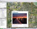
Do you use Google Earth? I do.
Its cool discovering cities, places and sights that you didn’t know about, before you stumbled across them in GE.
The coolest thing about GE is that it works together with Panoramio. If you jump to their site and click ‘help’ you can download a tiny file.
 And why is that cool you may ask?
Because it allows you to see and put pictures inside Google Earth. Not just pictures taken by professionals, but pictures by common people like well.me.
The pictures are placed on the map exactly where they are taken from. This gives a great idea of how things really looks like and you will not just get stunning sceneries.
Everyone can make an account there and post their pictures. The good folks at Panoramio then screens the pics for unwanted stuff and decide if it gives a good impression of the spot or not. If there already are plenty of pictures on the location, you may probably not strike lucky. So your best shot would be to find one location that you have been, that is not overrun by people and tourists. Posting is easy, but getting the pics accepted by Panoramio takes time.
I was pretty lucky to find Panoramio when they opened up some time ago, so already I have a few selected pictures. Especially from the area around Aalborg and then a few from China. I still have some pending from Yilan – China, but these can be found on my spot on Panoramio.